|
||||||||||||||||||
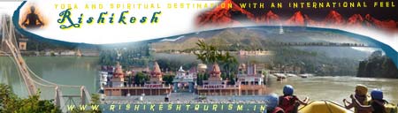
Rishikesh is located at 30.103368 �N 78.294754 �E. Rishikesh has an average elevation of 372 metres (1,745 feet). The Tehri Dam is just 80 km uphill on the way to Gangotri. Rishikesh is the starting point for traveling to the sites that form the Char Dham Pilgrimage � Badrinath Kedarnath Gangotri Yamunotri. Rishikesh Orientation The best way to go around Rishikesh is on foot as the town is hilly and consists of narrow lanes. To cross the river take a motor ferry from the iron suspension bridge known as Ram Jhoola, which is near Swargashram, or walk across either Ram Jhoola or Lakshman Jhoola, 2 km upstream. Practised riders take two-wheelers over them, disturbing what is otherwise a tranquil walk. Noisy tempos (called Vikrams or phatpatis) are affordable contraptions with amiable owners who have �arrangements�, so you might find yourself disembarking and getting on again en route, depending on the driver�s destination and the number of passengers left. |
| |||||||||||||||||
|
|
|
|
||||||||||||||||
|
|
||||||||||||||||||